 Lexington Polo Club Boulevard Connection
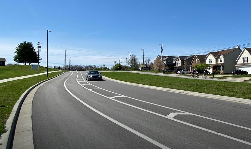
GRW provided survey and final design services for the connection of two pieces of Polo Club Boulevard in Fayette County from Deer Haven Lane to Todds Road. The work was done in close coordination with the LFUCG Division of Engineering and the Kentucky Department of Highways, and is a Local Public Agency (LPA) project.
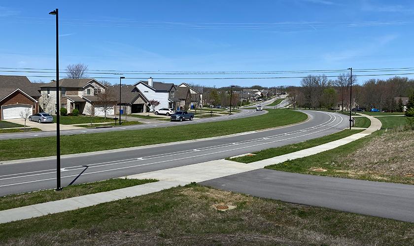
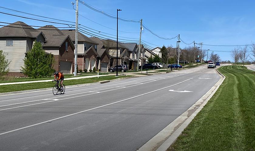
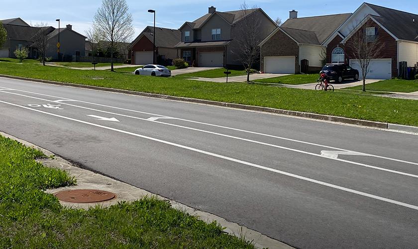
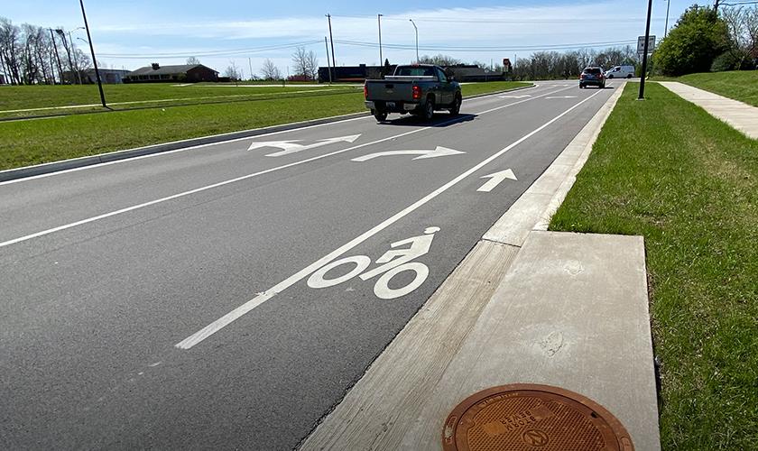
This project is a boulevard template with curb/gutter, sidewalk, bike lanes, and landscaping enhancements. It completes a critical section of a boulevard roadway system as envisioned in the Lexington-Fayette Urban County Planning Commission Expansion Area Master Plan. Issues related to the timing of development, needed property acquisitions and availability of government funding resulted in these two segments of Polo Club Boulevard remaining unbuilt.
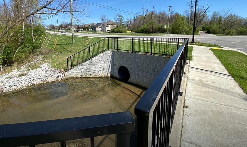
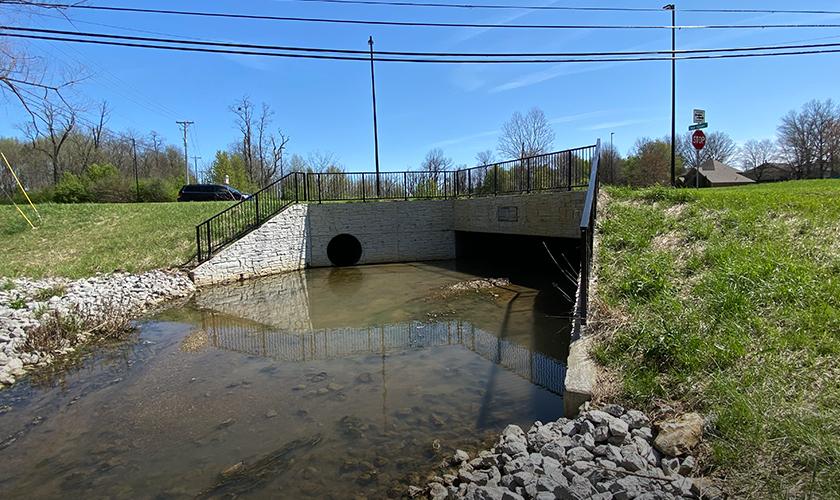
The first segment involves the intersection with Deer Haven Lane, while the second segment entails the extension of Polo Club to Todds Road along with a suitable connection. Design work included a 200-foot-long, double 16' x 4' box culvert to convey an existing stream and runoff of a 350-acre watershed. This stream crossing location is surrounded by a jurisdictional wetland. Using a collaborative approach, GRW successfully coordinated environmental evaluation of this area with the design effort. A 16' x 4' precast structure was used to minimize impacts to the environment and blend with the local surroundings. The stream crossing is also within the FEMA mapped floodway. GRW conducted floodplain and detention analyses to both preserve the wetland and avoid floodplain and floodway impacts. These efforts included coordination with the local floodplain coordinator and FEMA.
GRW provided conventional field work alongside state-of-the-art LiDAR survey techniques to expedite the mapping delivery. The final engineering design for the two remaining sections of Polo Club Boulevard included careful establishment of appropriate geometry to tie into the existing roadway and make the most of what has already been built. Spotty existing sidewalk construction was connected throughout with the application of current ADA standards. Existing utilities were investigated and mapped to minimize impacts.
This project also included a large stream crossing at Deer Haven that is surrounded by an area of potential wetland. Environmental evaluation of this area was thoroughly coordinated with the design effort. A 16' x 4' precast structure was used to minimize impacts to the environment and blend with the local surroundings.